Municipal Boundaries
The Geographic Services department in the Division of Property Assessments (DPA) maintains statewide municipal boundaries for all cities and towns in Tennessee. All annexations and de-annexations are to be recorded with the register of deeds and must include a detailed description of the territory. A copy of the resolution, map, and detailed description must be sent to the Comptroller of the Treasury and the assessor of property for each county affected. *
All questions and/or documents you have regarding this information provided should be submitted through cities@cot.tn.gov.
Geographic Services also serves as the Tennessee State liaison to the U. S. Census Bureau's Boundary and Annexation Survey by providing the U.S. Census with municipal boundary changes. The U.S. Census Bureau conducts the Boundary and Annexation Survey (BAS) annually to collect information about selected legally defined geographic areas. The BAS is used to update information about the legal boundaries and names of all governments. Numerous federal programs rely on accurate boundaries from each BAS.
* TCA § 6-51-121 for annexations and TCA § 6-51-203 for de-annexations
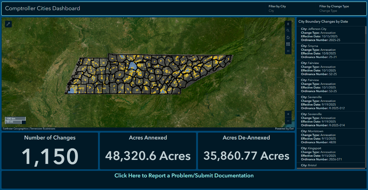
Comptroller’s City Dashboard
More Information
The links below directly link to pages concerning annexations and boundary changes within the corresponding agencies or departments websites.
The U.S. Census Bureau conducts the Boundary and Annexation Survey (BAS) annually to collect information about selected legally defined geographic areas. BAS is used to update information about the legal boundaries and names of all governments.
MTAS was created in 1949 to provide technical assistance to municipal governments within the state of Tennessee. They offer programs and services to cities and towns.
TACIR was created in response to legislative findings in the late 1970s indicating the need for a permanent intergovernmental body to study and take action on questions of organizational patterns, powers, functions, and relationships among federal, state, and local governments.
All questions you have regarding this site and the information provided should be submitted through cities@cot.tn.gov.